Hexcrawl Maps
A party gets back to town and reports a burned-out watchtower two days north. On Saturday a different group heads out that way. How do they know the tower is there?
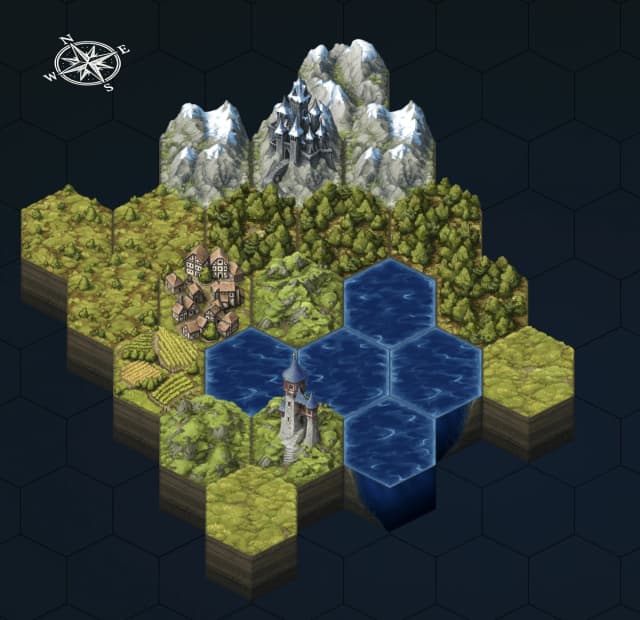
In a West Marches game, that's what the shared map is for. Here it's a hexcrawl map, a World Wiki page you paint with hex tiles and cover in fog of war. The campaign side of it is in Running West Marches.
You can try the editor without signing up. The demo map stays in your browser, and it has no location pins.
Hexcrawl DemoStarting a map
You make one in the Wiki Editor with New page → Hexcrawl Map. Just don't paint the whole thing before the first session. A free map has room for 961 hexes, and a party sees a few of them per adventure. Paint the land around town and a session or two beyond it, then stay a step ahead of the players.
Editing the map takes Can edit pages (Settings → Roles & Permissions). Keep that with the GMs, because whoever has it can edit the rest of the wiki too.
The tools
- TerrainClick a painted hex again with the same tile for its next variant.
- RoadsDrag from hex to hex and the pieces join up by themselves. Turn off Auto to pick one yourself, like a bridge.
- RiversDrawn the same way as roads.
- ObjectsHouses, wells and ruins, placed where you click rather than in the middle of a hex.
- RegionsColor in a kingdom or a stretch of dangerous country. The name only shows in the editor.
- TextPlace names. Give one a curve to bend it along a coast.
- Fog of warCovers what the players haven't found yet.
- LocationsPins that link to wiki pages.
So, what's past the river?
Fog is what makes the map work for a West Marches. Paint ahead, cover it in fog, and after each adventure erase the fog from the hexes the party saw. The next group sees what the last one found, and nothing more.
With several GMs, this is where painting ahead pays off. Any GM can open the editor, set Show fog as to See Through, and know what's in a hex before the party walks into it.
Pins and hex numbers
A pin can link to a wiki article, a map or another hexcrawl, so the watchtower on the map leads straight to its article. Each pin also has a GM Only switch.
Not every hex needs a pin, though. Turn on Coordinates in Map options and each hex shows its column and row, like 4,-2. Then keep a GM-only article that lists what's in each hex by number. It's an old hexcrawl trick, and it keeps the secrets off the map.
What players see
Players get solid black fog and no GM-only pins. For posting the new map in Discord after an adventure, Export as Image saves a picture of it. That's a Patreon feature.
Page settings
Draft, GM only and Allowed roles, under Settings in the editor's top bar, work as they do on any World Wiki page.
Map Compass is for an old map with flat-topped hexes. Tilt it 30° to fit the pointed tops here, and the compass shows where north went.
How big can a map get?
A free community's map is 31 hexes wide and 31 tall. At three miles a hex that's 93 miles across, which is a lot of frontier.
Patreon supporters can make it bigger. When someone on the lowest Patreon tier chooses your community, the map grows by 60 hexes in width and 60 in height. Higher tiers add more, and several supporters add up. Pricing has the numbers.
The free tiles cover plains, forest, hills, mountains, marsh, lakes and sea, including villages, castles, ruins and mines. The rest are a Patreon feature, all at the lowest tier. That's inns, smithies and other town buildings, harbors and shipwrecks, the full cold, desert, tropical and wasteland sets, and most of the objects.
Numbered hexes with a key are an old idea, and Justin Alexander's Hexcrawl series on The Alexandrian covers them in depth, along with travel and getting lost. Mystic Arts has videos on why 3-mile hexes make hexcrawls fun and drawing hex maps from outlines. Tile art by David G. Baumgart.